Both the GPSMap 60 and Rino 120 come with a basemap and the ability to store other Map Source products such U.S. Topo or Topo US 2008.
I am making a few assumptions based on the information you provide.
Assumption: You have created a waypoint and you selected it to Navigate to.
As an example you created a waypoint where you parked your vehicle (P1) and you have hiked to Hidden Lake Lookout. Now you want to hike back to your vehicle. You select Find P1 in your Waypoints, and you select GoTo.
I just did the task while setting here. I selected Buck Mountain, the Buck Mountain Page comes up and it shows the Latitude, and Longitude that Buck Mountain is located at. It also shows that it is located 4.47 miles North of my location. This page has no speed option.
I am given three options at the bottom of the page, Delete, Map (view), and Go To.
I select Go To. The Map Page pops up and it says to Buck Mountain across the top.
Another option has popped-up saying Follow Road, or Off Road.
I select Off Road, and the Map Page has a “Straight Line” to Buck Mountain. Across the top is a Message saying NE to Buck Mountain. Down in the lower left corner is the number 12, which is the scale of the map page I am viewing. The number in the lower left corner changes as I run the map scale up close or covering the State.
Realistically the hiker cannot hike the straight line, because the topography dictates the route you take.
http://www.glacieradventure.com/play/Recreation/Hiking/HiddenLakeLookout/index.htmI use the Track mode a lot in my current and past Garmin gps units. While they may have different buttons the Garmin Legend, 76C, 76Cx, and the Rino HCx operating language is similar. My tracks are never in a Straight Line. I have transferred them from my gps units and displayed them on Garmin Map Source U.S. Topo maps, and USGS Topo Maps. There are a few times I would have drown in a lake or fallen off a cliff if I had not circled around them.
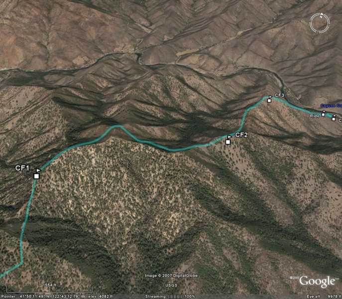
Sometimes I create a route, especially if somebody is going to pick me up at the bottom. Again I follow the country and not a straight line. I downloaded this route to Google Earth.

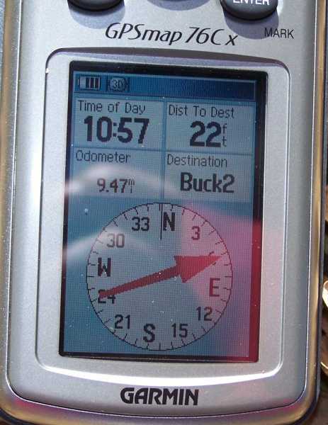
In this case I have my Gps Compass set up as a pointer and I am using it to navigate me to a successful stand.

Electronics will interfere with a gps at times, and I always have a compass and map in the woods.
I use my gps a lot and I set up navigation problems in the woods and on the street for self training. I have left my pickup in the woods and found it hours later taking a different route back to it. I have used it a lot on the water to return to fishing hot spots, without a problem. The Garmin Legend worked so good on my boat that I bought a fishfinder/Gps package for the boat.
A couple of months ago I purchased a Garmin automotive gps. It seems to operate in a different mode then the handhelds, but has excellent repeatability, and the software is great for finding address, hospitals, restaurants, and other sites. The displayed speed of the automotive gps and the handheld gps units when used in my pickup display a similar speed as the speedometer.
I failed to mention the RECALCULATE option. I will create another post.