I have ignored a topic for a while, but I will respond in this area and the subject fits, even if it is contrary to what the member wants to do. There are, and will always be a group of Huck Fins in the world. I was along with my buddies qualified. As kids we had the run of a number of neighboring ranches, and during hunting season we would hunt National Forest Lands. During the off season we would fish streams in the National Forest and on private ranches.
With permission to fish the streams on the private ranches came a discussion with the property owners in regards to respecting the property and the owners rights. Show disrespect and the right to trespass was rescinded. The county was large but the population was small, foul-up on one property and access to others was lost.
The lessons learned carried over to public lands.
I learn to Tread Lightly, and not to abuse the land.
Jumping forward more than fifty years I use three tools to help me Tread Lightly. Now days the primary tool is a gps, along with a compass and a map. Yes I carry a roll of flagging with me and when hunting I carry a length of it in my pocket and the roll is on a strap on my pack or web gear so I can access it as needed. A number of times I have shot a buck some distance out there, it might be 100-yards or more and the deer disappears. I immediately fasten flagging to brush or a limb so I can look back and see it. I will then take a compass bearing on the location the deer was standing when I fired the shot.
This is a modification of a hunt I made some 45-years ago. I spotted a buck and doe on a steep hill side across a couple of draws from me. I was standing in a mixture of buck brush and oaks. I was in an area that I did not know very well, I had been there a couple years before on a small lightning fire. On the shot the buck reared back on his hind legs and then went forward out of sight.
I hung my red handkerchief from a oak limb, pulled out my Silva Ranger Compass and shot a bearing. Once the bearing is shot the compass is set so the user can align himself using the back bearing. Before leaving this peep hole in the vegetation I took a hard look at the spot the buck had been standing. I noted a juniper tree on the edge of some protruding shale, and the location was on the shoulder of a minor ridge. This was a quick image of the location, not a long term study. It took a little bit of time to get to the suspected location. After looking around for the buck I pulled out the compass and took a back reading on the compass, I move a little bit to get the compass pointer aligned and I was able to see the red handkerchief in the shadows. At my feet was a dime size spot of blood.
http://www.tech4o.com/p-41-ranger-515-cl-compass.aspxIn a short time I found my dead buck.
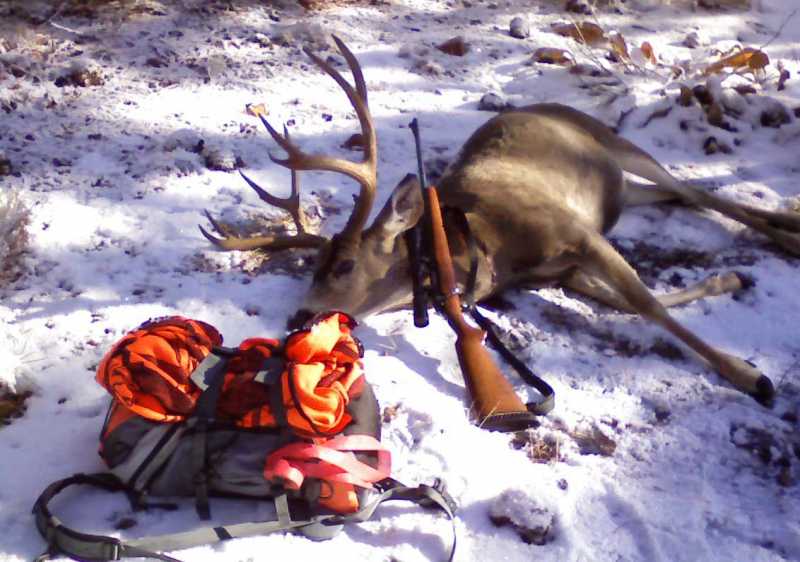
After dragging the buck down to my vehicle I hiked back up the hill and retrieved my handkerchief. Now days I using flagging, I will flag the spot I shoot from, I will flag blood drops when tracking a deer. When the mission is completed I go back and pull my flagging because it is not my property. I might miss a piece of flagging, now days I buy degradable flagging but I still have some of the old stuff. You can see the roll on my pack.

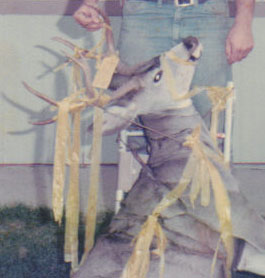
When I am packing out a buck I will flag the horns.

I do not want to advertise my success so you will find very little evidence of my passage. Admittedly after a deer is taken you will find a gut pile on the hill, drag marks on the ground, if the slope is steep you will see where my vibram soles have dug into the hill side, but nothing that is going to last beyond the next rain.
I have come to despise the guy (language moderated to meet site standards) who runs around cutting blazes into trees or chopping other signs into trees without a legal right as a TAGGER! A TAGGER is a bottom feeder who writes on bathroom walls, store fronts, or the side of railcars. We live in a world full of people. As an example Southern California contains approximately 24 million people. Many of the 24 million recreate on National Forest and Bureau on Land Management Lands within the area defined as South of the Tulare-Inyo County lines to the Mexican border, with Nevada on the East, and the Pacific Ocean on the West. As a wildland fire fighter and a Law Enforcement Officer I have had assignments on many of the eighteen National Forest in California and other Western States. In Southern California it appears about every love sick puppy has carved on the Alder trees along the streams. These wounds open the tree up to disease.
At the end of the 18th Century Basques sheepherders were employed to care for large herds of sheep. It was a lonely life surrounded by sheep, and a few dogs. The Basques carved some very interesting work on Western Alders. Archeologists have taken an interest in the carving and they are now protected. The destruction or modification of the Basques carving can be prosecuted as a felony.
When I was eleven years old my buddies and I were asked to join a Boy Scout troop in a nearby town. I benefitted from the experience. I got enough money together to buy a box compass and my best buddy purchased the better Silva compass. We learned to draw our own maps. While all the scouts had to have the Boy Scout manual, when funds allowed we later purchased the Scout Field Book. It contains some good information. Mine is the 1st Edition, 14th printing. It is not to difficult to go out in the woods, find a anchor point such as a rocky point, or a tree that is different. Using the compass the area before you can be gridded off. Before the day of the gps I used a compass to map the point of origin of wildfires. These maps held up in a court of law.
I was taught pacing, mapping, and compass use in Scouts. But my buddies and I held field trials on our own. All we needed was the spark to get us going. In those days it came from reading outdoor magazines.
I still carry a map, and the compass but my gps allows me to do many things, I can determined how many acres in an area of interest. I can put the gps in track mode, have it show on the screen and walk a grid to cover an area. I can save the track on the unit, download it to my computer, and print a map of my grid. With a Garmin or Magellan gps I can transfer the data to Google Earth and display it. I can create waypoints at key locations and they will be part of the data I can transfer.
I must have attended scout camp in 1955 or 56 and one of the first things we learned was not create rock trail markers. We were taken to an area in Southern Oregon where scouts had camped for years. It was amazing how many rock piles had been created by scouts. If taught correctly scouts will destroy their trail signs so not to create confusion. These rock signs have become a problem in the High Sierra’s and other location. There are volunteer groups that try and remove them, but every summer more sprout up.
I have attended a couple of Border Patrol tracking classes and others sponsored by S&R organizations. I have found that when man changes the way nature meant it to be, they leave sign and can be found. There are certain folks in California that are called Pot Pirates. They go looking for hidden sign that will lead them to a garden. This has grown more violent with the heavy insertion of Mexicans into the marijuana growing community.
Practices that were acceptable fifty years ago are no longer, even the Forest Service goes back to an area that has been flagged to define contract boundaries and pulls the flagging after the contract is completed. Leave no tracks, use a gps.
http://www.gboreloaded.com/forums/index.php/topic,191597.msg1098963562.html#msg1098963562